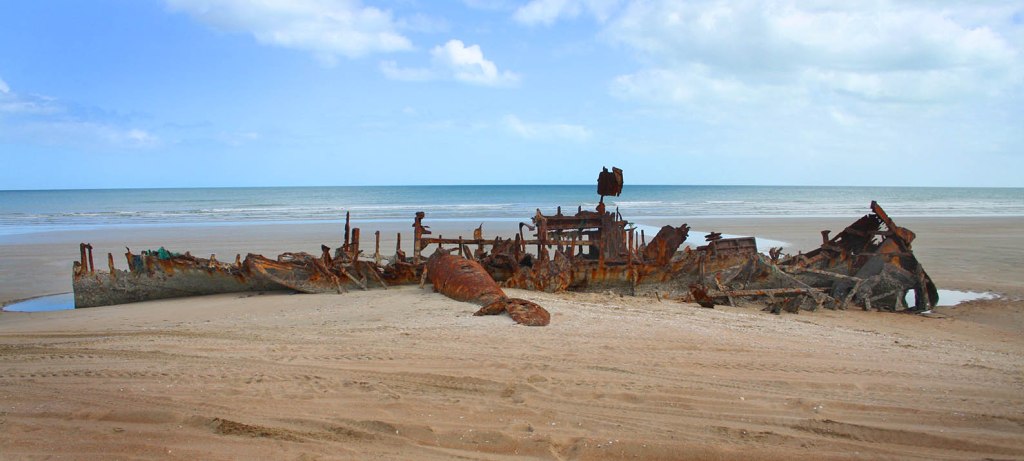
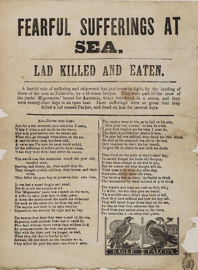
Category: Shipwrecks

  • The Post Office in the middle of nowhere

    Booby Island. Image courtesy National Library of Australia

       It might seem strange that one of Australia’s earliest post offices was also one of its most remote. It was set up on Booby Island in Torres Strait in 1835. However, the practice of passing mariners leaving correspondence on the island was already well established.

       Booby Island (Ngiangu to the Torres Strait Islanders) lies west of the tip of Cape York, about 1,800 nm or 3200 km by sea from Sydney. The nearest European settlement was the Dutch outpost of Kupang on Timor Island, 2000 km west across the Arafura Sea.

       Cook named the small outcrop Booby Island after the birds he saw nesting on its rocky slopes. The island would go on to serve as a crucial navigation landmark, especially for those mariners who had sailed up Australia’s east coast and were bound for Timor and beyond. Reaching Booby Island meant they had made it safely through the labyrinth of dangerous coral shoals plaguing the Torres Strait.  

       The earliest record of shipwrecked sailors finding refuge on Booby Island dates to 1814. The merchant vessel Morning Star, sailing from Sydney to Batavia, struck a reef and sank in Torres Strait. The crew abandoned the ship and made for nearby Booby Island. They were stranded there for five months, living in one of the island’s caves and surviving on rainwater and the seabirds that resided there. Then a sharp-eyed observer on a passing ship noticed a white flag being vigorously waved by one of the survivors. Five men were rescued. Twenty-two of their shipmates, including the captain, lost their lives.

       By the 1820s, ships were regularly passing through Torres Strait on their way from Sydney and Hobart bound for ports in India, China and England. Too many ran aground or sank in those remote and treacherous waters.

       In 1822, a flagstaff was erected on Booby Island’s summit, and a logbook was placed in one of the island’s caves so ships’ captains could register their safe passage through the Great Barrier Reef and Torres Strait. Those same mariners also began leaving sailing reports in the ledger to aid their fellow seafarers. The location of uncharted reefs or the strength and direction of hazardous currents were all recorded, sometimes at the cost of the vessel. Much of this information would be used to update later naval charts of the region.

    From an unidentified illustrated newspaper depicting Booby Island in the Torres Strait. Illustration Courtesy State Library of Queensland.

       Shortly after taking up duties as the Governor of New South Wales in 1824, William Bligh had the island stocked with barrels of fresh water, preserved meat and sea biscuits. Bligh knew stocking the island with provisions would go a long way towards saving the lives of sailors unfortunate enough to come to grief in those remote northern waters. He had first-hand knowledge of just how dangerous they could be. As a young Lieutenant, Bligh had sailed a small open cutter through Torres Strait after he had been unceremoniously relieved of his ship, HMS Bounty, by its mutinous crew.

       Then, 11 years later, in 1835, Captain Hobson of HMS Rattlesnake established the unmanned “post office” in one of the island’s small caves. The practice of leaving details of sailing hazards continued. But mariners also began leaving letters in the box in the hope they might be taken on to various destinations by other passing ships. For example, someone on a ship bound for India might leave a letter addressed to a recipient in Canton, China. The next ship bound for that port would take it on to its destination.   

    When the Upton Castle stopped briefly at Booby Island in 1838, one of its passengers visited the post box and described it thus,“[it is] covered with canvas and well secured, and supplied with a quantity of pens, paper, and ink, and pencils in excellent order.”

    Early illustration of the Booby Island Post Office.

    It is worth remembering that the only other post office in Australia at the time was in Sydney.    Melbourne would not get a post office for another couple of years and it would be seven years before another post office appeared in what would become Queensland.

    In the span of just 15 years castaways from at least ten ships owed their lives to Booby Island.   The Coringa Packet, and Hydrabad (1845) Ceres (1849), Victoria (1853), Elizabeth, Frances Walk   It is worth noting that, at the time, the only other post offices in Australia were located in Sydney and Hobart. Melbourne would not get a post office for another couple of years, and it would be seven years before Brisbane got one.

       In the span of just 15 years, castaways from at least ten ships owed their lives to supplies left at Booby Island. Survivors from the Coringa Packet, and Hydrabad (1845), Ceres (1849), Victoria (1853), Elizabeth, Frances Walker and Sultana (1854), Chesterholme (1858), Equateur, and Sapphire (1859) and many more before and since made for the island after their ships were lost.

       Booby Island remained a vital refuge for shipwrecked mariners and a place to exchange information until the 1870s, when a government outpost was established on nearby Thursday Island.er and Sultana (1854), Chesterholme (1858), Equateur, and Sapphire (1859) and many more before and since made for the island after their ships were lost.

    Booby Island remained an important refuge for shipwrecked mariners and a place to exchange information until the 1870s when it was supplanted by a government outpost on Thursday Island.

    Copyright © C.J. Ison, Tales from the Quarterdeck, 2021.

    To be notified of future blog posts, please enter your email address below.

  • The Mystery Ship of Walga Rock

    The Mystery Ship of Walga Rock

    The drawing of a sailing ship at Walga Rock, 350km from the Western Australian coast. Photo: C.J. Ison

    Tucked away at one end of an Aboriginal art gallery at Walga Rock is a clear depiction of a European sailing vessel. What makes this truly extraordinary is that Walga Rock lies more than 350 km (220 miles) inland from the nearest place where the rolling waves of the Indian Ocean crash against the Western Australian coast.

    The picture has intrigued travellers and academics for the past century, ever since its existence became known outside the Wajarri people on whose land Walga Rock is found.  

    The painting is stylistically very different to everything else in the extensive gallery.   It looks to be a depiction of a specific vessel and there is what could be Arabic verse in the same white ochre below it.    

    A section of the art gallery. Note the style and subject matter is substantially different to the ship drawing. Photo: C.J. Ison.

     Several theories have emerged as to its origin.    

    Some people believe the picture is of one of the long-lost Dutch ships which came to grief off Western Australia’s rugged coast in the 17th Century.    The VOC ships Batavia and Zuytdorp head the list.   

    The Batavia was wrecked off the Abrolhos Islands in 1629 and while the captain sailed a longboat to Batavia (Jakarta) to get help, a bloody mutiny unfolded among the remaining survivors.   When rescuers finally arrived most of the mutineers were rounded up and hanged but two were put ashore near present-day Kalbarri at the mouth of the Murchison River.    It is possible these men may have been taken in by local Aborigines and followed the Murchison River inland to the Wajarri people’s land and made the painting.

    Dutch ship Zuytdorp, 1712.

    The Zuytdorp sailed from Holland in 1711 bound for Batavia but never arrived.   The remains of a shipwreck were discovered 40km north of Kalbarri in 1927 but it was not until 1954 that it was identified as the missing Zuytdorp.   It was speculated that survivors may have been adopted by the local people and, over time, moved inland along the Murchison River.   Dutch silver coins, part of the ship’s cargo, have been found at water holes far inland, giving some strength to this theory.

    Others have speculated that in the late 19th Century, a Wajarri man may have travelled to Port Gregory or Geraldton on the coast and returned to make the illustration of a sailing ship he had seen.

    Another theory is that an Indonesian pearl fisherman named Sammy Hassan made the depiction early in the 20th Century.  It is thought that he was brought to Shark Bay to work in the pearling industry with 140 other boys on the steamer Xanthos in 1872.   Forty-five years later, aged about 60 he was reported to be living among the Wajarri people by early settlers and soon after, the picture was first noticed in the rock art cavern.   Unfortunately, there is also a report that a “Sammy” had died as a result of a shark attack back at Shark Bay.

    So, if it was not Sammy who made the picture?   It may have been one of the other boys, also named Sammy, brought out from Malaya and Indonesia to work as pearl divers.

    Top: The Dutch ship Zuytdorp; Middle: the Walga Rock drawing; Bottom: The steamer Xanthos. The Walga Rock drawing bears a stronger resemblance to the bottom image.

    The strongest evidence for the last theory is the drawing itself. It bears a striking resemblance to the Xanthos, which only plied Western Australian waters in 1872 before it sank at Port Gregory. The two masts and funnel and the painted faux gun ports match the Xanthos as does the flat deck. The Dutch ships Batavia and Zuytdorp both had three masts and a high stern, making the Xanthos a stronger contender.

    The upper-Murchison River and country around Walga Rock was explored and prospected from the 1850s onward.    But I could find no mention of the painting of a European ship on the gallery wall prior to the early 20th Century which is the era fitting the Sammy / Xanthos theory.  

    Walga Rock art gallery. Photo: C.J. Ison.

    Regardless of the drawing’s origin, Walga Rock is a fascinating place to visit and the image opens a window on several aspects of Australia’s colonial and maritime past.

    I would like to thank the Wajarri elders and community for allowing the public to visit the Walga Rock art gallery.

    © Copyright C.J. Ison. / Tales from the Quarterdeck, 2020.

    To receive notification of future blog posts please enter your email address below.

  • The Bourneuf’s Tragic Last Voyage

    Cross section of emigrant ship Bourneuf. From Illustrated London News 10 July 1852.

       On 3 August 1853, the 1500-ton Bourneuf sank in Torres Strait as she was returning to England. It was ironic that her return was cut short, for her voyage out to Melbourne, Victoria, had been no less tragic. She had left Liverpool in mid-July the year before carrying some 800 impoverished emigrants keen to start new lives in Australia. But one in ten would never make it.

       Convict transportation to New South Wales had ceased two years earlier, and the recently constituted Victorian Government had introduced an assisted migration program to try to solve a chronic labour shortage. The colony had long been short of domestic servants, farm labourers, and other workers, but the recent discovery of gold had only exacerbated the problem. Meanwhile, England was still grappling with the social dislocation brought about by the Industrial Revolution. There were more people than there was jobs. On the surface, the migration program appeared to solve both intractable problems; however, transporting the migrants halfway around the world proved costly. Not surprisingly, there was an incentive to transport the largest number of people at the lowest cost to the Government.

    Emigration Depot at Birkenhead, Liverpool. A ship, possibly the Bourneuf, about to depart for Australia in 1852.

       The emigrants, many of them families with young children, were crammed into the Bourneuf’s two tiers of tiny cabins. Passengers were required to prepare their own meals in tightly packed communal kitchens. Bathing and toilet arrangements were rudimentary at best and maintaining good hygiene was impossible from the outset in the overcrowded confines of the ship. The close, fetid conditions were the ideal environment for the spread of communicable diseases. And, it was not long before people started coming down with dysentery. By mid-voyage, measles and scarlet fever were sweeping unchecked through the ship, taking a terrible toll.

       Isolating the sick proved impossible, and for much of the passage, ten or more people, mostly children, died every week. By the time the Bourneuf dropped anchor off Geelong on 20 September, disease had claimed the lives of 83 passengers. The ship was immediately placed in quarantine while 20 desperately ill passengers recovered.

       It would be nice to think that this had been an incident, but that was not the case. Four ships packed with assisted migrants made the long passage out to Victoria in 1852; the Wanota, the Marco Polo, the Ticonderoga and, of course, the Bourneuf. All were grossly overcrowded, even by the standards of the day. Disease outbreaks raged on all four ships with terrible consequences. No fewer than 279 passengers died on the four voyages. Many more passengers had to be hospitalised and quarantined on arrival. However, the lesson was eventually learned, and the Emigration Commissioners limited future migrant ships to carrying no more than 350 passengers.

    Example of immigrant accommodation on the 1874 James Craig barque at the Maritime Museum in Sydney, New South Wales, Australia. Photo C.J. Ison.

       The Bourneuf remained in Port Phillip Bay for ten months, eventually setting sail on 18 July 1853 divested of her passengers. She sailed from Melbourne bound for Bombay before continuing back to England.

       Captain Bibby made his way up Australia’s east coast, pushed along by a south-easterly trade wind. After first passing through the Tasman Sea, he continued north into the warm tropical waters of the Coral Sea. The Bourneuf remained several hundred kilometres off the coast and well outside the Great Barrier Reef. This had become known as the “outer passage” and was considered by mariners to be safer than navigating close to land inside the reef. Captain Biddy intended to cross through the Great Barrier Reef at the Raine Island entrance so he could carefully pick his way through the labyrinth of shoals that lay in Torres Strait.

       Unfortunately, it appears that Captain Biddy had miscalculated his run towards the entrance. At 1 a.m. on 3 August 1853, a lookout spotted a thin white line of breaking surf looming out of the darkness. By the time the danger had been seen, it was too late to take evasive action. The ship slammed into the Great Detached Reef about 15 kilometres south of the Raine Island entrance. Unrelenting swells from the Pacific Ocean pounded the stranded vessel. Captain Bibby gave the order to abandon ship. Thirty-nine people took to three lifeboats that night.

       Two of the boats managed to get clear of the stricken vessel, and the survivors were later rescued by the Dutch ship Everdina Elizabeth. Captain Biddy, his wife, sister-in-law, and five crew drowned when huge waves capsized their lifeboat while they were still alongside the Bourneuf.

       The Bourneuf is just one of 37 ships known to have been lost in or near the Raine Island Entrance during the 19th Century.

    © C.J. Ison/Tales from the Quarterdeck, 2020.

    To receive notifications of future blog posts please enter your email below.

  • The Loss of Carpentaria Lightship CLS3

    The rusting remains of Carpentaria Lightship CLS3 which was washed ashore at Vrylia Point on Cape York in January 1979 during Cyclone Greta. Photo C.J. Ison.

    With an estimated 8,000 or more shipwrecks in Australian waters you could be mistaken for thinking the country’s foreshores would be littered with the remains of long-lost vessels standing silent testament to the dangerous waters they sailed.    In fact, there are surprisingly few recognisable shipwreck remains dotting Australia’s coastline.   

    One I had the opportunity to visit a few years ago was the old unmanned Carpentaria Lightship CLS3 which was driven ashore on the remote west coast of Cape York.

    Three Carpentaria Lightships moored in the Brisbane River near Peters Slip, Kangaroo Point circa 1924. Photo courtesy State Library of Queensland.

    The Carpentaria Lightship CLS3 was one of four built at the Cockatoo Island Dockyard in Sydney between 1916 and 1918.  

    They were designed by the Scottish naval architects Charles and David Stevenson, and measured 22 metres in length, 7.8 metres breadth and 2.7 metres draft and displaced 164 tonnes.     The hull was constructed of riveted steel plates.  

    An acetylene powered gas light sat atop a mast amidships and was visible 18.5 kilometres (10nm) away.   The vessels carried sufficient acetylene to keep the light burning for six months so there was no requirement for them to be manned.  

    There were also mechanisms to switch the light off during the day and for them to flash their distinctive codes when operating.   The lightships were also fitted with a bell which rang as the ship rolled to warn nearby vessels of impending danger.

    They were the first lightships to be built in Australia and most of their long careers were spent in Queensland waters.  

    Two were always on station, one in the Gulf of Carpentaria and the other at Breaksea Spit north of Fraser Island.   The other two were held in reserve undergoing maintenance and ready to be rotated with those at sea.  One of the Carpentaria Lightships, CLS4 was later used in Bass Strait before being retired in 1985.

    Carpentaria Lightship CLS4 at the National Australian Maritime Museum in Sydney, New South Wales. Photo C.J. Ison

    The Carpentaria CLS3 was moored at Carpentaria Shoal off the north west coast of Cape York when in January 1979 Cyclone Greta struck. The lightship broke free and was driven south-east towards Cape York beaching a little north of Vrilya Point about 65 kilometres south of Thursday Island. Attempts to haul the vessel off the beach failed and she has remained there rusting away ever since.

    Carpentaria Lightships CLS2 and CLS4 can now be seen at the Queensland Maritime Museum in Brisbane and the Australian National Maritime Museum in Sydney.

    © Copyright C.J. Ison/Tales from the Quarterdeck, 2020.

    To receive notifications of future blog post enter your email address below.